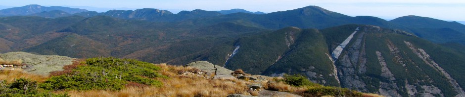
The long ridge of Rocky Peak Ridge (RPR) stretching down to Rt. 9 on the right side.
Rocky Peak Ridge: #20 4,420′

East Trail to Rocky Peak Ridge (RPR)
The ascent of Rocky Peak Ridge (RPR) from Rt. 9 is a strenuous climb with a terrific pay off. The total ascent amounts to 5,128′ (more than the ascent of Mt. Marcy from the ADK LOJ). The total mileage is about 13.5 miles. The trail rolls over several lesser peaks along the way, descending into cols between high points and meandering over many expanses of open rock with amazing views. The trail goes over Blueberry Cobbles, Mason Mountain, Bald Peak, and Rocky Peak on it’s way to the summit of Rocky Peak Ridge. (Yes, Rocky Peak and Rocky Peak Ridge are two separate and distinct parts of the same mountain, the summit of this high peak is called Rocky Peak Ridge).

Artistic rendering of the East Trail to RPR
The trail starts at a trail head on Route 9 near New Russia. Look for this sign:

Trail sign at the parking area on Rt. 9 near New Russia
The trail begins with a nice walk through the woods and gradually gains elevation. After two miles on this pleasant trail you come to Blueberry Cobbles at 2,080′. There is an alternate route that bypasses the summit of Blueberry Cobbles, saving some elevation gain and rejoining the trail on the other side. This bypass is only slightly shorter. Just before this split there is a nice view point.
Continuing on the trail climbs up and over Mason Mt with first hints of rock sections and breathtaking views. After a short decent into a col, the climb starts to get a bit more strenuous. At 4 miles from the trail head, Bald Peak is 3,060′ tall. This is where the open rock sections start in earnest. There’s a really big rock up there that’s fun for bouldering. This section is a walk along an open ridge with breathtaking views; which have the potential to be disheartening as you can see your next challenge (Rocky Peak) looming ahead. Bald Peak on it’s own would be a lovely destination for a hike.

Ty and me on trail enjoying the view

Tiera on Bald Peak pointing to our next destination, Rocky Peak

Tiera and Tyler at one of the many steep sections of the trail
Once up the challenging side of Rocky Peak, at 4,060′, there is a fantastic view point where you can see in all directions. From there the trail dips into the col between Rocky Peak and Rocky Peak Ridge where the trail encounters the tranquil Mary Louise Pond. The pond has a unique beauty nestled between the peaks. Moving around the pond and up is the final half mile push to the summit of RPR.

Mary Louise Pond at 6.1 miles into the hike, in the col between Rocky Peak and RPR.

Looking back at Mary Louise Pond, Rocky Peak, and Bald Peak from the side of RPR.
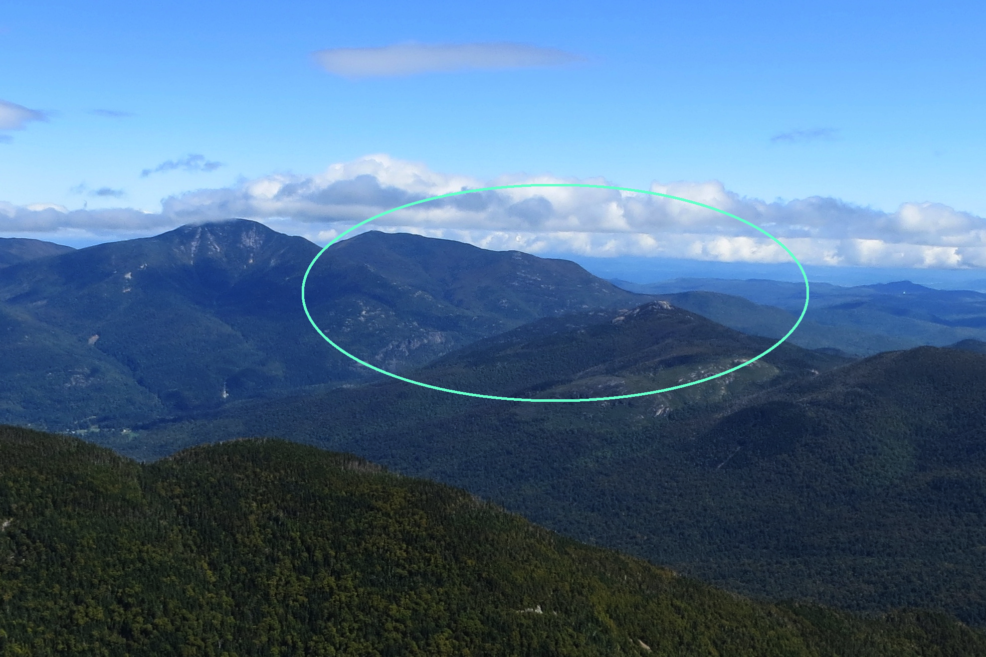
Once on the rocky top of RPR continue until you find the massive cairn marking the summit. There is an closeup view of neighboring Giant and it’s slides, and amazing views of the Dix Range, Colvin Range, and Great Range. On a clear day you can also see the Marcy group and the MacIntyres. Enjoy the beautiful summit but be prepared for a windy and cold stay up there.
There are two trail options from the summit of RPR, the long trail back to Rt. 9 or the trail to Giant. (See the description of that trail here) Either way, the trail from the summit requires more elevation gain and several miles, so be prepared with lots of water and snacks! See the final picture of this post for a view with some of the mountains labeled.

Tyler, Tiera and I at the summit cairn on RPR

Tiera and her hula-hoop, continuing the awesome tradition of hula hooping in epic places (with Giant to the right and a fantastic view of the Great Range behind her)

Happy hiker summit shot with Dix behind me in red, Dial in pink, Allen in white, Haystack in orange, Marcy in yellow, Colden in green, Algonquin in blue, and Wright in purple.
Happy hiking!

Nice write-up. Beautiful, this hike has been on my short list.
Good for you. Fabulous images and super breakdown of a challenging hike.
Ryan